Identify the best place to look for your next new home
Moving for schools and a commute is three searches at once. VennMap puts school catchments, average house prices and how far you travel for work on one map, and shows you where they overlap.
No account. No tracking.
How it works
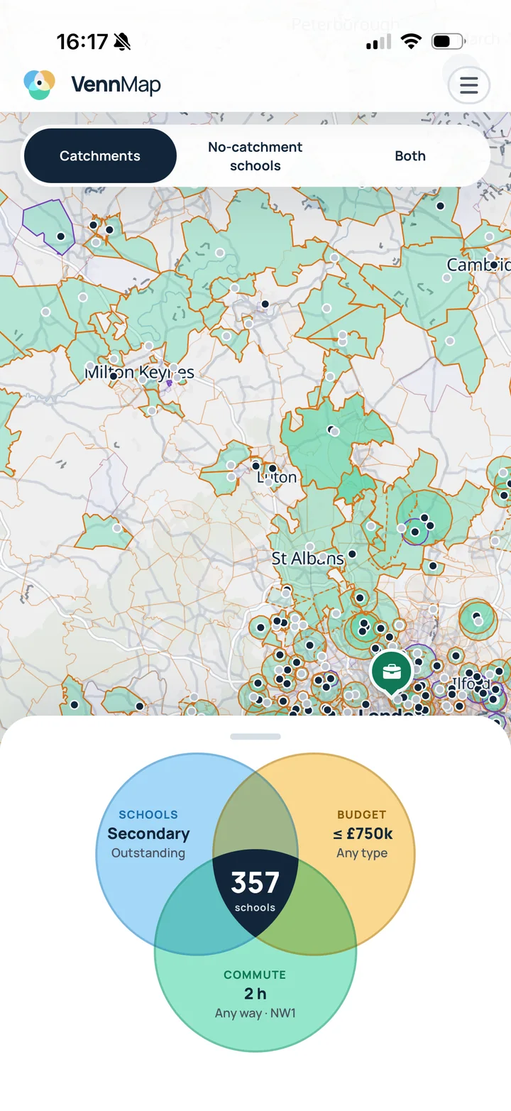
Set three filters. The map shows where they agree.
Each one takes under a minute. Change any of them and the map and the count update straight away.
Schools
Catchments
Primary or secondary, Ofsted Good or Outstanding, grammar and independent if you like. A catchment is the council's official boundary where it publishes one; otherwise the area nearer to that school than any other, capped by distance. Councils' real rules may differ, so please check before you commit.
Budget
Average house prices
Land Registry sales in the last 12 months inside each catchment, for the home types you pick. Set a ceiling and the map keeps the catchments where a typical sale falls under it.
Commute
How far you travel for work
A typical weekday morning by the ways you choose, from TravelTime: drive, train, or drive to the station then train, up to two hours. Real journeys vary with traffic and timetables.
The schools in the middle are the answer.
A school you'd want, whose catchment you can afford, inside your commute. The app counts them, shades their catchments on the map and fades everything else back, so you can see at a glance where to look.
The app
From a shaded catchment to a viewing in two taps
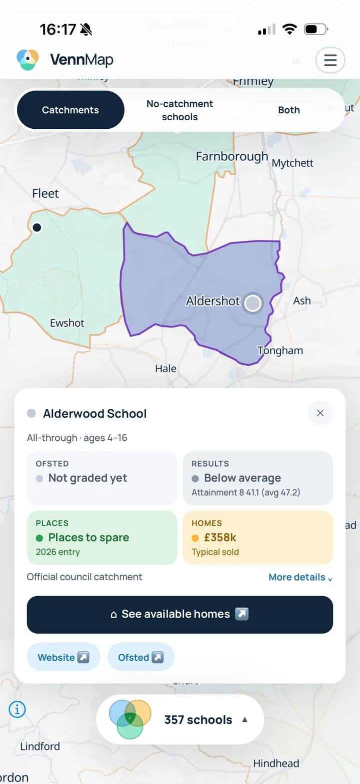
Tap a catchment for the school
- Ofsted grade and results. Attainment 8 or KS2 scores against the national average, so "Good" has a number behind it.
- Places for the next entry year. Whether the school had places to spare or was oversubscribed, and the last distance offered where the council allocates by distance.
- Typical sold price in that catchment, and whether the boundary is the council's official one or an estimate.
- See available homes opens Rightmove or OnTheMarket with the catchment already drawn and your filters pre-set. Hold to select several catchments and search them together.
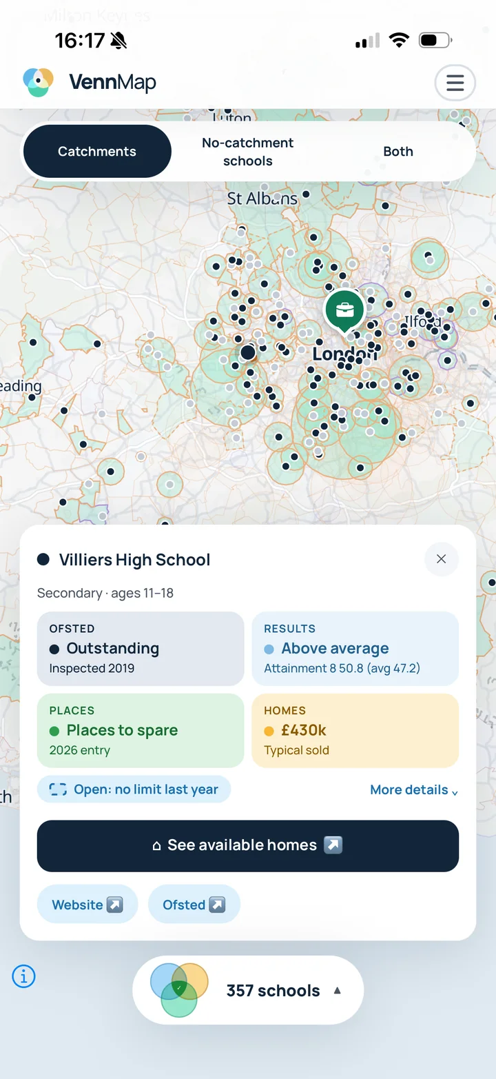
Every matching school, wherever it is
- Rush-hour journey times, drawn from your work pin as far as you'd travel, by car, by train, or by driving to a station first.
- Add a partner's commute and the map keeps only the places that work for both of you.
- Catchment schools, no-catchment schools, or both. Schools that admit by distance or had no limit last year show as pins, so a good school with an open door isn't hidden.
- Compare with where you live now. Add your current postcode to see today's journey times and catchment schools alongside anywhere you're considering.
The data
Built with open data
Every layer in VennMap comes from a public source. Here is what each one means and how far to trust it.
- Catchments
- Official council boundaries where councils publish them, and the council's last distance offered where places are allocated by distance. Where neither exists, the catchment is estimated from distance to the nearest comparable school and marked approximate. Admissions rules change every year; check with the school before you commit.
- Schools
- Department for Education, Welsh Government and Scottish Government records, with Ofsted grades and performance tables for England. Grammar and independent schools are included where you ask for them.
- Prices
- Typical HM Land Registry sold prices from the last 12 months inside each catchment, for the home types you pick. These are past sales, not asking prices or valuations. Catchments with very few sales use the nearest sales instead.
- Journey times
- A typical weekday morning, modelled by TravelTime. Real journeys vary with traffic and timetables; check a real timetable before you rely on one.
Coverage
- SchoolsEngland, Wales and Scotland
- House pricesEngland and Wales
- CommutesGreat Britain
Northern Ireland postcodes are not supported.
Sources
How accurate are catchments?
of homes get the right school
Tested against about 2,100 real catchments in 25 English councils. Where a council publishes its boundary, VennMap uses that instead.
VennMap is an estimate
Nothing here guarantees a school place, a price or a journey time. Check with the council, the school and a surveyor or solicitor before deciding anything.